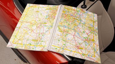
The best road atlas
Total reliance on sat-nav can get you into trouble. We pick three of the best printed road atlases from the 12 tested

Despite the growing sophistication of sat-navs, there is still a big market for the traditional road atlas. Sat-nav prices are falling, but they still cost a lot more than a map book. A road atlas is also ideal for planning, as it allows you to see the big picture – a small smartphone screen just won’t cut it.
Our quest for the best involved checking for up-to-date maps, plus extras like town-centre plans, an index and details of ports and airports. Finally, we factored in the purchase price, accounting for the different formats.
Winner: A-Z Great Britain Road Atlas
Price: £12.95
Scale: 3.5 miles per inch
Contact: 01732 783422, www.a-zmaps.co.uk
This A4 map book from former winner A-Z stood out among the 12 contenders in our test thanks to easy-to-interpret mapping and handy features such as bookmark flaps built in to the cover. We also a the quality back cover key and clear junction diagrams. There are 170 pages of road maps, plus versions for route planning, as well as some speed camera locations.
Commended...
Michelin Great Britain Road Atlas
Price: £12.99
Scale: 3.5 miles per inch
Contact: 01923 205240, www.viamichelin.com
This Multiflex version of Michelin’s A4 atlas is a halfway house between a paperback and spiralbound, as it folds flat. This is handy, as it retains the durability of a conventional spine. Inside, it features our preferred 3.5 miles per inch scale, with good junction detail and easy-to-read mapping. You also get 80 close-up maps and a useful list of restricted motorway junctions.
A-Z Great Britain & NI Super Scale Road Atlas
Price: £14.95
Scale: 2.5 miles per inch
Contact: 01732 783422, www.a-zmaps.co.uk
Our pick of the big A3 books. Not as easy to use in the car, but not as bad as it could be, as it’s spiralbound. The upside to the large size is that detail is impressive, right down to which road crosses another at complex junctions. The 2.5 miles per inch maps were the clearest on test and we liked the points of interest listing, plus town and city-centre coverage.
Road atlases Q and A
I’ve already got a sat-nav – do I really need a road atlas, too?
The main reason for having a road atlas is that you will always know where you’re going – even if your sat-nav has no satellite reception or battery charge. Atlases make it easier to share your route with others and can help you explore areas you don’t know. If you’re on holiday, you might not want to take the fastest road, or you may want to see what landmarks are close by.
What’s the difference between the many road atlases on sale? Which one is best for me?
First, there’s size - pocket, A5, A4 or A3. Then the size of the scale – the lower the figure, the more detail. Your next choice is between hardback and paperback. Although paperbacks are cheaper, hardbacks are more durable. Finally, the spine: spiralbound, perfect bound or stapled. We prefer spiralbound as it can be folded back on itself.
Find a car with the experts


